Published on
May 5, 2025

GIS and remote sensing mapping to strengthen coastal conservation efforts in Solomon Islands
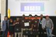
A week-long training on using open-source GIS tools and remote sensing satellite data from SPC's Digital Earth Pacific (DE Pacific) will now enable Solomon Islands government officials and researchers to better map, monitor and protect seagrass and …
Source:
Pacific Community (SPC)
-
Center-left